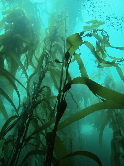
D’Entrecasteaux Channel, Bruny Island and Far South
The northern part of the D’Entrecasteaux channel is very sheltered from all except strong southerly weather. There are a number of sandy bays that give way quickly to a thick silt that supports large numbers of sea cucumbers, scallops and bottom-dwelling fish.
However, in terms of interesting scenery, much of the western coast is sandy and relatively disappointing until the dolerite cliffs of Cape Labillardierie are reached in the far south. Increased water exchange make the dives cleaner and more scenic. This area is much more easily reached from the Dover boat ramp.
South of the Huon River the area is flushed by clean ocean currents. This has provided a number of more scenic dives on rocky reefs. The best diving is on the more substantial dolerite reefs from Dover to Recherche Bay. The major drawback of the southern area is that it is more exposed to the swell. However, there is still plenty of easy diving in the sheltered bays at Port Esperance, Recherche and Southport.
Bruny Island – Storm Bay and southern side
There is some good diving on the north-east side of the island. To dive this area it is easier to launch from one of the boat ramps at Tinderbox or South Arm. It is a long trip down the seaward side of North Bruny. The area is quite shallow, but still has some interesting kelp gardens. The eastern side of Bruny is very exposed and is often subjected to strong winds and swell. This is even more noticeable in the south, where the cliffs are directly exposed to prevailing south westerly swell. The ‘channel’ side is often very sheltered and sometimes mirror calm. Even here divers need to be wary. Small and overloaded craft can be easily swamped by southerly storms.
On the south and south-east coastline of Bruny, the cliffs become very high and the reefs more substantial. The Friars even has a seal colony. In good weather it is the scenery is absolutely superb and there are some good reefs to be found in deeper or more sheltered areas.
Services
The nearest diving services are located in Hobart. Services on Bruny island are confined to the small towns of Alonnah and Adventure Bay.
Road and Boat Access
Public boat ramps can be found at many locations, but the most strategic are located at Woodbridge, Gordon, Charlotte Cove, Dover, Southport and the Catamaran River (Recherche Bay). The area is served by the Huon and Channel Highways which offer easy access for all vehicles.
Access to Bruny Island is by vehicular ferry from Kettering. The major drawback here is the extra cost of to taking over a boat trailer. There are few boat ramps on the island with Adventure Bay offering the only reliable access to the seaward side of the island. All the ramps on Bruny tend to be shallow and steep. The southern coastline can be reached from Adventure Bay or Dover. The easiest diving is on the more accessible reefs around Adventure Bay.
Tinderbox Marine Reserve
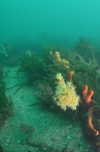
Rating 6 stars Depth: 2-6 metres Category 1-2
Nearly every diver in Southern Tasmania is acquainted with this site. Every basic course includes an almost compulsory trip to Tinderbox. The site has a number of advantages. It is close to Hobart, relatively sheltered, and has many items of interest. The site was proclaimed a Marine Reserve in order to protect the area as a recreational asset. Prior to this declaration the stocks of fish, crayfish and abalone were exceedingly low. They have since bounced back significantly and the marine reserve has since been extended to the Fishermen’s Haul area. All the diving in the area is relatively shallow and consists of narrow rocky reefs that soon give way to a silt/shell grit bottom. The best reef diving is on the reefs to the north, which are wider and support more marine life. Here you can find a good cross section of typical Tasmanian marine life. The cliffs to the south are much narrower and are in very shallow water which is great for an easy snorkel dive.
The sediments in the centre of the bay are still interesting, especially for the photographer and at night. One interesting animal looks like a juvenile lobster, but is actually an adult species of crustacean called a craylet. At night time the bottom is covered in brittle stars, octopus and Cardinal Fish. The occasional scallop can also be found, but it has never been legal to take scallops in this part of the channel. You may also notice an attractive pink coral known as a Lace Bryzoa. These turn white when taken home and dried out. In any case it is now illegal to remove living or dead material from the Marine Reserve.
The only risks come from boat traffic at the nearby ramp, tow a dive flag. Well away from the shore there can be a slight current at times during spring tides. There can also poor visibility after heavy rains and strong winds. Generally the site is very sheltered and safe.
Tinderbox Artificial Reef
Rating 5 stars Depth: 10 metres Category 1-2
To attract fish life and provide a bit of a diversion on the muddy bottom, local dive clubs created two artificial reefs. This was done some years ago before the site became a Marine Reserve. The smaller reef consisted of a series of tyres and an old wooden boat. This small reef lay close to the southern cliffs, just out from the moorings. Recently this reef has been covered over and dispersed. A similar fate is about to befall a larger reef in the middle of the bay. The reef lies about 200 metres out from the boat ramp out beyond the moorings. Unfortunately this is close to the main track taken by boats using the ramp. It would be advisable to tow a dive flag. The reef was originally made of hundreds of bus tyres, a small wooden boat, cars and numerous other small items. This reef is now packed with growth and makes a welcome change from the flat and muddy bottom in the area. The site has attracted schools of fish in particular. Small crayfish have begun to colonise the reef as well as delicate sponges and coral growths. The only warning is to leave plenty of air and energy for the reasonably stiff swim home,
Fishermen’s Haul
Rating 5 stars Depth: 2-5 metres Category 1-2
This area is a popular alternative to Tinderbox and provides some easy snorkel diving opportunities. Fishermen’s Haul is the small bay to the south of Lucas Point. There is a small parking area at the top of the cliff, and a narrow dirt track winds down to the rocks. This track is very steep and can be slippery at times. In high tides and heavy seas it may be dangerous to enter off the rocks. The area is fairly exposed to south-easterly swells. Rough weather will also produce low visibility. The area is a good place to get an introduction to snorkelling as the bay is shallow and has quite a few things to see. Scuba divers may wish to venture further afield and there is a nice kelp garden on Lucas Point. Save some energy for the return trip as it is a steep climb back to the car.
S.S. “Laura” Hulk
Rating 4 stars Depth: 2-4 metres Category 1
This site is an easy and safe snorkel dive that works well if combined with a picnic or some other outdoor activity. The wreck site is located in Little Peppermint Bay and can be accessed at low tide by walking around the headland from Woodbridge. The “Laura” was an old river steamer that once traded around the South-East Coast. She had a reputation for inefficiency and this probably contributed to her eventual demise. She was sold as a hulk and scuttled as a breakwater. The wreck now sits on a bottom of mud and pebble and although her hull is badly corroded, she is still fairly intact. The bow is high and dry while the stern is submerged in shallow water. If you wish to climb onto the wreck beware, the wreck is weakening rapidly and may be unstable and dangerous. The large steel structure in the middle is the upright boiler once used to power the engines. The large steel propeller is quite spectacular and would be worth a ‘ship and diver’ photograph. Good for a lazy day out.
Green Island
Rating 5 stars Depth: 5-10 metres Category 2
I have dived on the northern side of this island, which lies in the middle of the D’Entrecasteux Channel off Middleton. The water exchange here is fairly poor and as a result the visibility can be low at times. The bottom is made up of mud and shell grit, broken by a few rocky outcrops. The seaweed growths tend to be fairly thin. It is a very easy dive that is suitable for beginners when the weather is good. The island is easily accessed by small boat from any of the numerous boat ramps in the area. The area is very beautiful and contains an interesting variety of bird life.
Zuidpool Rock
Rating 5.5 stars Depth: 3-12 metres Category 2
This site is easy to find because it is marked by a large navigation beacon. The dive is an interesting experience because everything looks so different. The run-off from the Huon River can give the water a greenish tinge, which is an odd experience. The site is covered in Butterfly Cod which would normally only live in deep water and is also popular with Long-Finned Pike, Trumpeter and various types of Leatherjackets. The south-east side of the reef also contains a nice garden of white sea whips in 12 metres, although these come and go. At times a slow current flows over the site and it would be safer to remain close to the boat.
Close to the island there is a flat rock shelf that supports a rich weed garden. In calm seas it is an attractive snorkelling area. The rock then drops away about 40 metres out from shore onto a series of small ridges in 10-14 metres depth. There is interesting marine life here for the underwater naturalist. It is fairly barren on the southern end of the reef although this is where you will find some of the more colourful invertebrate growths. The island is home to plenty of Butterfly Perch, Leatherjackets, Wrasse and Rock Cod. In still conditions it is a very relaxing short dive.
Nine Pin Pt Marine Reserve
Rating 6 stars Depth: 6-9 metres Category 2
This extensive system of reefs stretches about 100 metres from the shore, into the Huon River. Tannic acid in the Huon River reduces light levels and seems to encourage deep water species to move into the shallows. Bearded Rod Cod, Weedfish, Pipefish, and Leatherjackets are also common. It is now illegal to remove crayfish or abalone from the site. The kelp gardens near the shore are also quite attractive. The site is fairly sheltered and can be dived in most conditions, except for heavy southerly weather. Due to the uniqueness of the area the site is now a Marine Reserve. The Parks Service has placed a gate at the start of the access road. You can ask for a key or simply make the fairly short walk down to the shore.
Charlotte Cove
Rating 4 stars Depth: 2-6 metres Category 1
This is a good dive to do once when the weather is too rough in D’Entrecasteux Channel. It is an easy dive for beginners. The best diving is on the rocks around the point. This area is being rapidly sold up for housing development, so you may need to get permission from the local landowner to gain access to the site. A thin band of rocky reef hugs the shore and supports a small and very thick kelp garden. Occasionally the site is darkened by run-off from the Huon River and this tends to lower the water temperature at times. This is most noticeable after a period of rain and southerly wind. Normally the dive is very simple and relaxing. If launching boats from Charlotte Cove, beware of the ramp. It is shallow and rocky and is really only suitable for smaller dinghies. If you have a boat there are some nice reefs on nearby Garden Island too.
Butts Reef
Rating 5 stars Depth: 8-15 metres Category 2
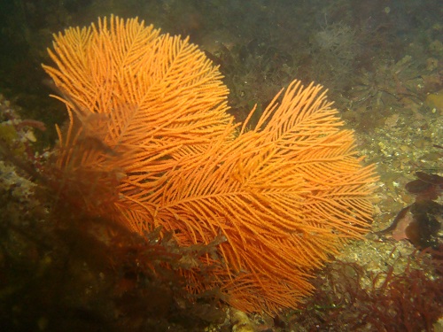
This extensive area of reef lies in the middle of the mouth of the Huon River just south of Charlotte Cove. The reef is easily located as two marker poles have been driven into the rock around the shallow top of the reef. The site is usually sheltered, but occasionally suffers from bad visibility and a current when the river is full of fresh water. Generally the reef is clear as the prevailing south westerly weather tends to push the tannin stained surface layer onto the shoreline around Charlotte Cove. Around the markers it is only 5-8 metres and the flat reef top spreads over an area about the size of a football field. The top of the reef offers a shallow weed garden with a few small bommies. The weed garden has some species of delicate brown algae, but tends to be dominated by crayweed and strapweed. On the sheltered northern side it slopes away slowly into a thick weed garden in ten metres. The western and southern sides drop away sharply onto silt and sand in 13-15 metres. The slope on the southern side is perhaps the most attractive area. This dive is relatively good for those eager to improve boat handling skills without taking the risks involved with a more exposed open ocean dive.
Blubber Head
Rating 6 stars Depth: 5-10 metres Category 2
Blubber Head marks the northern extremity of Port Esperance. It is normally a safe and easy dive, except in strong southerly weather. The erosion of Blubber Head has created a steep underwater slope which is dominated by large boulders. These boulders provide holding points for a variety of seaweeds and have attracted many reef fishes. One feature of the dive is the large variety of Leatherjacket species found here. These include the colourful Toothbrush and Horseshoe Leatherjackets. It is obviously dived and potted regularly. The site can be accessed by boat from Dover.
Wreck of the “Katherine Sharer”
Rating 6 stars Depth: 15 metres Category 2
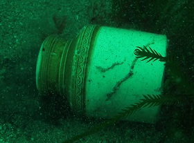
The “Katherine Sharer” left Gravesend bound for Hobart with emigrants and general cargo. The cargo included everything from door knobs to a printing press. She also contained eight tons of gunpowder. On June the 6th 1855 they reached the D’Entrecasteux Channel and anchored. That night the alarm “fire” was given and smoke began to billow from the forecastle. The fire progressively took hold of the ship and panic set in as everyone realised what would come next. The Captain gave the order to abandon ship and all made it to the shore safely. Nearly two hours later the ship was engulfed in a huge explosion and disappeared. Those hiding in the bush were showered with debris including cans of herring and parts of the ship’s rigging. The mail bags landed half a mile inland. The crew were suspected and a seaman was arrested and unsuccessfully tried for setting fire to the ship. Three years later Tasmania’s first diving fatality occurred here, when a salvage diver drowned after an epileptic fit.
Divers from the Marine Board relocated the wreck in the 1940’s and started to recover parts of the cargo. Some have claimed that there were valuable copper tokens onboard. This story encouraged early divers to blow up the wreck in search of valuables. To my knowledge only a handful of coins have ever been recovered and plenty of effort has been spent looking for them. If any coins existed I feel that they ended up in the hands of the person who set her alight in 1855. In 1944 the wreck was the site of Tasmania’s first sport dive when some local daredevils tried out probably a home-made hard hat.
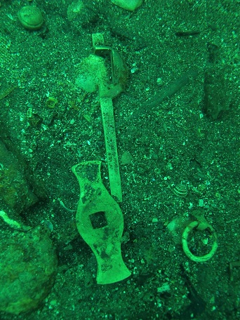
More recently suction pumps were used to recover artefacts. The cumulative effect of all this has been to disperse the wreck and remove most of the cargo. There is still quite a bit of structure to the wreck thanks to the shipworm resistant character of its teak beams. When I first dived the wreck there were plenty of interesting little household items to look at, but most of these have now gone. The wreck is still of interest and there are still a few small items to see. The wreck once stood high off the bottom, but is now difficult to locate even with a depth sounder.
Lomas Point Reef
Rating 6 stars Depth: 10-20 metres Category 2
This reef lies on the southern side of Port Esperance near the wreck of the “Katherine Sharer”. The reef is easy to locate rocky outcrops in deeper water with an echo sounder. Most divers will be content to poke around the main boulder field, which once had an impressive kelp forest in 10 metres of water. There is also a good chance that you will find pieces of wreckage from the “Katherine Sharer”. The actual wreck site is about 500 metres away, so this will give you some idea of the force of the explosion. I have seen a diver recover two intact salad oil bottles from this reef. By some miracle they survived the blast.
Wrack Bay (Garrett’s Bight)
Rating 5 stars Depth: 5-15 metres Category 2
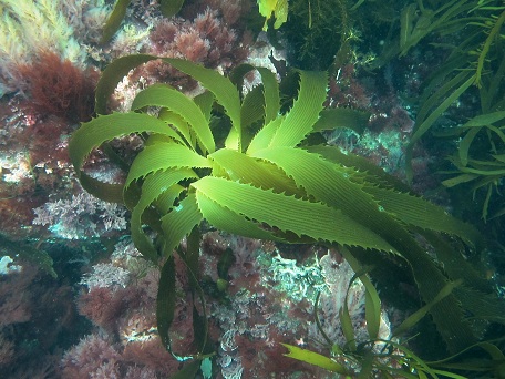
This is a very attractive and easy dive that often enjoys fair to good visibility. It is exposed to the southerly swell and adverse weather will make it a difficult area to reach. A number of large reefs and rock form shelter for an array of marine life. There are also a few sand-filled gutters alongside the reefs and these provide the opportunity to see a few different sand-dwelling fish. The reefs are better if examined slowly. It is possible to find some interesting smaller animals such as nudibranchs. On the whole, a pleasant and relaxing dive in good weather.
Southport Convict Cemetery
Rating 6 stars Depth: 5-10 metres Category 2
As you might have guessed this site is located near an old cemetery from the convict era. It is located in a conservation area a few kilometres to the north of the Southport jetty. The foreshore is basically a sea terrace that is surrounded by a low cliff. The area is very exposed and rough weather will quickly reduce the visibility. If the swell is breaking hard onto the rocks it is better to go to Lady Bay for a dive. Check out a safe entry and exit spot before you get in. A small bay just around the point can be a handy exit point. Make a cautious entry and move away quickly to avoid being buffeted against the rocks. The shelf drops virtually straight onto a fairly sparse bottom in 5 metres. Out in ten metres the dive is more scenic and the rocky reef is about 150 metres wide near the cemetery. There is a nice seaweed garden with a good cross-section of reef fish. The reef narrows quickly near the point. In this area large boulders are home to a few small marine critters. It becomes very shallow in the bay around the point and the seaweed is more delicate. This is home to a diverse range of small reef species. This bay is a good place to finish off the tank. At the exit point you are about 100 metres from the car park so don’t overdo it on the walk back.
Lady Bay
Rating 6 stars Depth: 5-10 metres Category 1-2
Apart from a reasonably tricky entry this is an easy shore dive for most divers. Some care is needed when entering from the pebbly beach, as it is easy to lose your footing when fully laden. Close to the shore there is a thick bed of kelp clinging to a low rocky reef. Further out the bottom gives way to silty sand and thin Macrocystis kelp, but there is still a good range of fish life to be seen. Fitter and more adventurous parties may find a better dive if they are prepared to swim out to the far point, but that is beyond the capacity of most.
Evorall’s Point
Rating 6 stars Depth: 2-4 metres Category 2
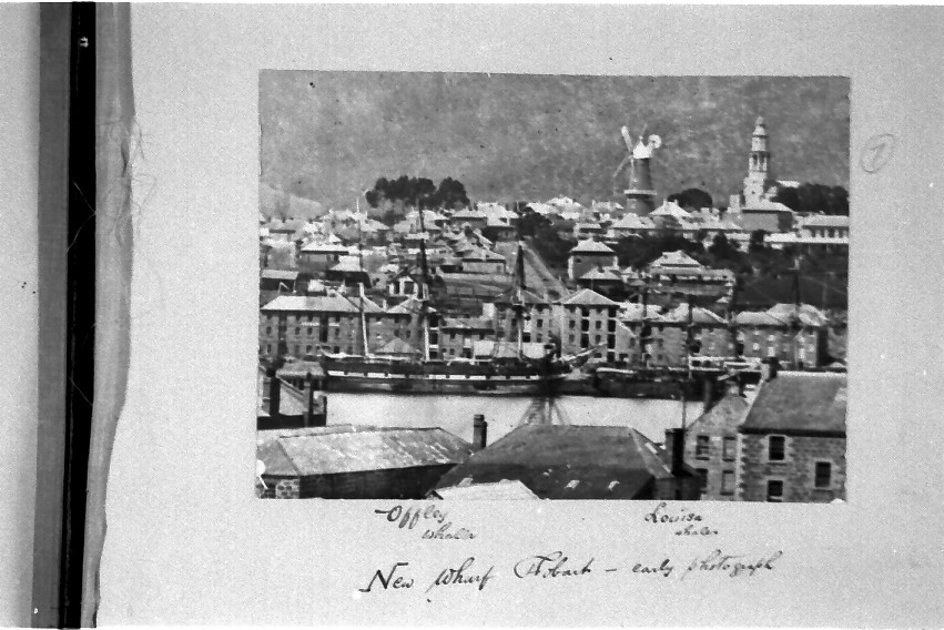
Evorall’s Point was once the rail head for the old Catamaran coal mines. Steam trains and steam-driven trucks brought coal from inland mines to the loading bins that once stood on the point. The jetties and rail formations are now gone and the chassis of an old steam truck now lie rusting in the scrub. The site looks like it had never seen this sort of activity and the greatest noise is now the incessant buzzing of some ferocious mosquitoes. An old rusty boiler marks the start of the access road which is accessible by foot for snorkelers and very fit shore divers, most divers will need a boat. A walk takes you close to Waterhole Cove on the southern side of the point. A short walk through the scrub in the opposite direction, will bring you to Coalbins Bay. This bay is close to good seaweed gardens on the tip of the point. On either side there is safe entry and exit. Waterhole Cove seems to have a more restricted water exchange and much of the swim is across a muddy bottom covered in lumps of discarded coal. The southern and eastern side does offer the remote prospect of seeing parts of the old 376 ton whaler “Offley”. She was blown onto the point in 1880 and was dragged into the bay and broken up. Parts of her were still visible in the 1970’s and they may become visible again with further sand movement. The more exposed seaward reef offers a very nice kelp garden. There are very luxuriant growths of different species of seaweed and all the common varieties of reef fish. A very attractive dive that is suited to beginner divers. Novice divers should avoid the more exposed seaward side in rougher weather.
Kelly’s Rocks
Rating 6 stars Depth: 4-15 metres Category 2
At the end of a prominent headland in the middle of Recherche Bay lie Kelly’s Rocks. These exposed rocks not far from the shore are named after James Kelly, a prominent Hobart whaling identity. The submerged rocks further out to sea are called the Denmark Reef. These two sets of rocks are actually the main spires of a larger volcanic reef system. The reef is about 500 metres long and varies in width from 50 to 200 metres. The rocks are also quite attractive with some impressive growths of weed. In addition there is a large garden of delicate seaweed in the shallow water on the northern side of the peninsula. The dive is shallow and fairly sheltered and is a good first boat dive for newer divers. The Kelly’s Rocks area is probably the best diving inside Recherche Bay. The whaler “Maria Orr” was wrecked on Kelly’s Rocks in 1846. She must have been heavily salvaged as no-one has managed to find remains, except for a few pieces of copper sheathing on the north-western side of the rocks. This 289 ton barque, built in 1838, was the first major trading vessel constructed in Tasmania. At the time of her sinking she was on a voyage to the South Seas loaded with stores.
Fisher Point
Rating 5 stars Depth: 4-15 metres Category 2
This area was once the site of an old bay whaling station. Snorkellers can easily reach the point via a short walk over Planter Beach. It is possible that you may find old whalebone and implements on the shallow sandy beaches close to the point. This will depend on the extent of recent sand movement. I am certain that the National Parks archaeologist would want you to look at, but not remove anything that you find. Close to the Fisher Point light there is a small offshore reef that provides a relatively safe anchorage from the southerly swell. This 15 metre dive is a good alternative scuba dive when you are unable to get further out to sea. The rocky bottom provides holding points for a nice kelp garden. Access is via small boat from the ramp at the Catamaran River.
Black Reef
Rating 5 stars Depth: 4-6 metres Category 2
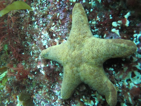
There are many reefs in Tasmania named Black Reef and like the others this one gets its name from the dark patches of kelp that can grow over the site. The dive is located about 8 kilometres from the boat ramp at Catamaran River. Black Reef is about halfway between Actaeon Reef and the mainland. At high tide this reef can be very difficult to see in calm weather. In any sort of a swell a noticeable break is seen on the surface. The area is very exposed to the southerly swell and may not appeal to those interested in scenic wonders. The shallows are dominated by Bull Kelp which soon gives way to a more appealing seaweed gardens, including Macrocystis kelp. The swell has tended to scour the bottom but there are still a few rocky outcrops.
Actaeon Island
Rating 6 stars Depth: 4-15 metres Category 3
The ship “Actaeon” was wrecked here in 1822 on a voyage from Isle De France (Mauritius) to Hobart. The wreck lay on the reef for a time and much of the cargo was saved. Heavy weather eventually smashed her to pieces. The location of this wreck is not currently known. The nicest part of the island is the landward side which is also relatively sheltered waters with often a thick forest of kelp. The island is about 12 kilometres from the ramp in Recherche Bay and can only be dived in very calm weather.
Sterile Island
Rating 6 stars Depth: 5-9 metres Category 3
Sterile Island is a small barren rock that forms part of the Actaeon Reef chain. The water around the island is fairly shallow and gets a pounding from the swell. On the seaward side the bottom is dominated by Bull Kelp. On the southern end of Sterile Island a reef runs just below the surface for many kilometres, terminating in the South-East Break. This rock claimed the wooden sailing ship “Wallace” in 1835. The wreck of the “Wallace” consists mainly of a couple of cannon and some scattered ironwork. Exceptionally calm weather is needed to dive the area. If you are thinking of stealing the cannon, forget it. Without proper conservation an iron cannon soon becomes a worthless, crumbling pile of junk. Leave it there for everyone to look at.
Ship File – “Wallace”
Built: Alloa Scotland in 1835
Features: Wooden ship of 338 tons
Partridge Island
Rating 6 stars Depth: 2-10 metres Category 2
The northern side of this island is a popular dive because it is sheltered from the prevailing southerly swell. As you might expect the area is heavily fished. The water is quite shallow and covered in thick weed. On the Channel side of the island the diving becomes more spectacular in a tall Macrocystis forest. It is certainly worth bringing a camera. On the seaward side it becomes progressively deeper as you head further south. The kelp eventually gives way to a barren type of bottom covered in green seaweed. A good dive for a larger group seeking a range of different diving within a small area.
The Pineapples
Rating 6.5 stars Depth: 5-15 metres Category 2
‘The Pineapples’ are a series of very impressive rock formations hugging the coast near the Cape Labillardiere cliffs. Access is via a fairly long boat ride from Dover. It will be a difficult journey in strong southerly weather, so it is handy to have an alternative dive in mind. A rough beach launch could be made from Old Port Road on Cape Bruny by small craft with a 4WD tow vehicle. The Pineapples is a great dive for anyone who likes poking around the rocks for small marine life. It is believed that the four gunned 376 ton ship “Enchantress” sank near here in 1835. She is Tasmania’s only real ‘treasure ship’ and it is thought that she was carrying a valuable cargo. You might be told that it is full of gold bullion but the ‘treasure’ is apparently family silverware being brought out by rich settlers. This silverware would require proper conservation to keep its value. She probably sank out on the sand in deeper water. If you do find it I know that the maritime archaeologist in Hobart would be very interested. The wreck is historic and the Historic Shipwrecks Act requires divers to disclose the wreck’s location.
Quiet Bay
Rating 5 stars Depth: 4-8 metres Category 2
This area lies in the lee of Cape Bruny and offers a sheltered anchoring spot. The centre of the bay is dominated by thick beds of brown seaweed. The rocks around the area are surrounded by sand and pebbles that seem to be popular with Conger Eels and small bottom-dwelling sharks. The diving is better the closer you go to the open sea. Here there are some attractive gardens of seaweed. Although easy diving the site is difficult to reach. It would make a good second dive after a deeper dive on the cliffs around Cape Bruny.
Court’s Island
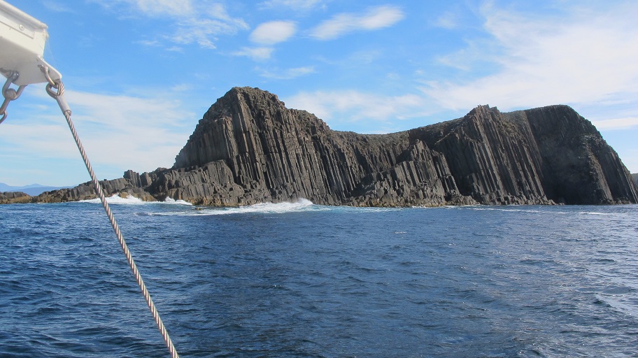
Rating 7.5 stars Depth: 20-25 metres Category 2
The western side of Court’s Island can be sheltered from south-easterly weather and offers fairly safe anchorage in moderate conditions. Although remote, the area is worth the effort. The whole area is very beautiful and tends to enjoy good visibility. The cliffs drop away sharply into over 20 metres of water in some areas. The bottom here consists of a series of reefs broken by long sandy gullies. A lot of small marine life grows on rock faces covered in colourful sponges. This is a difficult area to reach. Very calm weather is required.
The Friars
Rating 7.5 stars Depth: 20-30 metres Category 3
‘The Friars’ is a huge, fairly flat, dome of rock studded with impressive rocks and islands, that promises to offer a wide variety of dive sites for the explorer. Unfortunately the area is very exposed and difficult to reach. I have only been able to dive this area twice. In sheltered spots the diving here it is brilliant. On the NE side of the islands the shoreline of the bays is noted for its large blocks of volcanic rock, split by numerous swim-throughs. The marine growth in these cracks is very good, particularly if more sheltered reef can be found in the 25-30 metre range. The area is also patrolled by seals from nearby haulouts. The exposed and shallower sections are less interesting thanks to the prevailing south-easterly swell. Divers be warned that there can be a strong current in the channels between the islands. The area is also very exposed and it is a long run to the nearest safe anchorage. This dive is reserved for large and well equipped craft. The drive to the site is one of the highlights with excellent scenery and usually lots of seabirds, schooling fish, seals, dolphins and the works.
Cape Connella
Rating 6 stars Depth: 10-12 metres Category 2
The eastern side of Bruny Island is very exposed and it can be difficult to find safe anchorages against the high volcanic cliffs. In northerly weather and moderate seas, it is possible to anchor under the lee of Cape Connella. Close to the high cliffs the water is a shallow 5 metres. The swell has removed most of the delicate marine growth from the pebbly bottom. It is much nicer in deeper water where you will be less affected by the swell. The seaweed here grows more luxuriously. In about 10-12 metres there are a series of large rocks that shelter some marine life. The reef continues out further and slopes down gradually into about 18 metres without revealing better conditions. The area is most conveniently accessed from the boat ramps in Adventure Bay. It can be a long and difficult run in unfavourable weather.
Penguin Island
Rating 5 stars Depth: 5-15 metres Category 2
This area is very frequently dived and potted because of its proximity to boat ramps at Adventure Bay. Despite this heavy fishing pressure it is still a good place to find pleasant kelp gardens and interesting marine life. The island is skirted by narrow and fairly steep rocky reef, that quickly gives way to sand. The northern side of the island is almost permanently ringed with nets and cray pots. While it can be a fairly sheltered site, it is still affected by the swell and visibility can be poor in bad weather. The sea caves on the mainland side look interesting, but are shallow and particularly exposed to the swell. The bottom around these caves is also sandy and relatively uninteresting. Instead it is probably better to spend the dive just poking around the reef on Pelican Island itself.
Quiet Corner- Wreck of the “Natal Queen”
Rating 5 stars Depth: 2-4 metres Category 1
As the name suggests, Quiet Corner is a sheltered location that is an easy shore dive. It normally boasts a very thick garden of Macrocystis kelp which attracts plenty of reef fish. The dive is very popular with young spear fishermen who dive the area heavily during the school holidays. They do a good job of terrorising the local population of Wrasse and Leatherjackets. It is highly likely that you will see small pieces of wreckage from the barque “Natal Queen” in the intertidal zone. This vessel was blown onto the rocks in 1909 during a heavy storm. Two other vessels were wrecked nearby in the space of a few days. The remains of the “Natal Queen” consist of a few iron ribs on the shore and a pair of anchors out in deeper water. The diving in Quiet Corner is shallow and sandy so you may need extra weight to stay on the bottom.
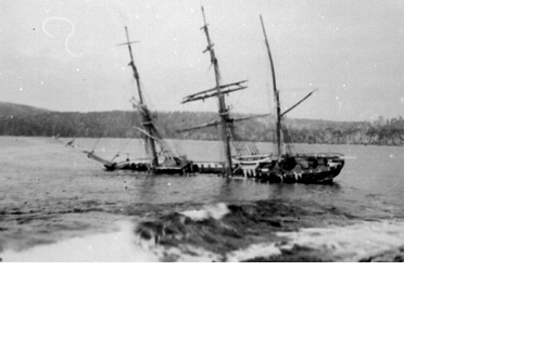
Ship File – “Natal Queen”
Built: 1866 Grangemouth, Scotland by Adamson & Co
Dimensions: 113.8 ft x 23.5 ft x 12.7 ft
Features: Wooden barque of 230 tons
Variety Bay
Rating 6 stars Depth: 5-15 metres Category 2-3
This area can be quite difficult to reach because the eastern side of Bruny is very exposed and it is a long boat journey from the nearest ramp. The actual diving itself is quite easy as the water is fairly shallow. I have dived on the dolerite cliffs on the southern side of the bay. Here the bottom drops away only slowly into a fairly modest 15 metres. Because of the shallow and exposed nature of the dive it usually lacks the delicate invertebrate life found at other locations. However, the seaweed grows luxuriously and ocean currents often bring in school fish. The area also has a strong resident population of common species of reef fish. Good weather is essential.
Top Slip Point
Rating 6 stars Depth: 5 metres Category 2
This dive is on the sedimentary rock cliffs north of Trumpeter Bay. In a heavy sea it would be a difficult dive because of the site’s exposure to swell. However, the swell has caused the soft cliffs to erode, leaving rubble on the bottom and creating small caves in the cliff face. For this reason these cliffs support more small marine life than the harder dolerite cliffs nearby. The cracks and swim-throughs are covered in zoanthids, jewel anemones and sponges. The best diving is in the shallows among the caves and rubble. Further out it deepens quickly into 15 metres, but it is a fairly flat and featureless bottom. The cliffs also attract Bulleyes, Weedfish, Bearded Rock Cod and Trumpeter. The dive is a pretty, shallow dive that will attract the naturalist and photographer. The dive is also moderately close to the boat ramp at Tinderbox.
