Collendina Reefs
6-10 metres
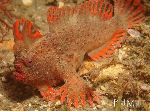
Sometimes known as “breakers reefs” these bommies lie off Collendina Beach (between Ocean Grove and Pt Lonsdale) and the break is visible from the shore. The reef is in the surf, so is out of bounds unless there has been a persistent northerly blow for a few days. Lots of Port Jackson sharks and other fish life collect around the reef, so on a good day it can be an excellent dive.
Wreck of the “Light of the Age”
2M
The 1280 ton wooden ship “Light of the Age” was originally built in 1855 as the “Beacon Light”, by Jotham A Stetson in Chelsea, Massachusetts. Between 1862 and 1866, the Light of the Age made several voyages to Australia under the Black Ball Line flag, mainly carrying emigrants to Queensland. In 1865 a shipping slump forced the Black Ball Line to sell the “Light of the Age” and it was bought by the White Star Line.
On her last voyage, the Light of the Age’s was carrying a general cargo and 42 passengers. Captain Porter was reportedly drunk before the ship even left Liverpool, and he stayed in his cabin throughout the voyage. The later Court of Inquiry stated, “the ship was badly navigated”. Off the Heads, the captain was so drunk that he did not understand the pilot’s signals. The thick weather suddenly lifted and breakers were seen ahead. At 1.30am the vessel touched and then went aground. During the subsequent rescue operation the second officer was “drunk and obstructive”, the cook and steward were also drunk, and the captain was described as “stupidly drunk”. Soon after the crew had escaped a strong southerly winds pushed the Light of the Age broadside on to the beach and she began to break up.
The site of the Light of the Age was found by divers in late 1960s, and soon became a popular diving site. Huge amounts of intact crockery were removed from the wreck. Larger items including a signal cannon and an anchor were removed. In 1982 someone used explosives, resulting in the site’s complete destruction and the remaining items became scattered and broken.
The site today is 100M offshore and consists of the remains of a winch, iron fittings and mast bands, and a 30m square scatter of crockery lying in a sandy gutter between two reefs running parallel to the beach. A large sand mound lying inshore is reputed to cover the other remains of the vessel. The site is subject to surge and can only be dived on calm days, with low swell and northerly winds.
Wreck of the “Orungal”
7M

The 5826 ton steel steamer “Orungal” was built in Glasgow in 1923 as the S.S. “Fezara”. The “Orungal” operated in as an interstate passenger and mail steamer between 1927 and 1940. In 1940, the laying of minefields in Bass Strait by the Axis powers led to brown-outs and mine sweeping in the channels near the Pt Phillip Heads. Arriving at Port Phillip Heads from Sydney, Captain Gilling was attempting to enter the Heads in bad weather and had been warned by the Navy not to deviate from the swept channel. In the worsening weather a blur of lights at Barwon Heads was mistaken for Port Lonsdale, and the “Orungal” steamed ashore onto Formby Reef, just east of the entrance of the Barwon River. By 5A.M., oil from a burst oil line was helping to calm seas around the Orungal enough for the lifeboat to approach, and all the passengers and crew were taken off. On 13 December 1940, a major fire broke out. The ship was soon ablaze and by mid morning the armaments magazine exploded. When the fire ended the salvors moved in. By 1945 the wreck had disappeared beneath the waves.
Two Scotch type boilers are exposed at low tide, just north-east of the small boat channel at the entrance to Barwon Heads. Large sections of steel hull plating and framing, and impressively large pieces of ships structure and machinery including masts, booms, deck winches, propellor shaft, flywheel, and a thrust block lie scattered about and make the site an interesting shallow dive. The site is subject to waves and surge, and is best dived on flat calm days.
Barwon Heads Bluff Marine Sanctuary / Wreck of the “Earl of Charlemont”
5-9m
Drive through the foreshore camping ground up Ewing Blyth Drive past the footy oval to the car park at the end of the road. Do the short walk over the crest and check out the sea. If there is lots of white water head home. Otherwise, gear up and walk down the ramp to the beach and turn left. Walk onto the rock shelf and go east. Enter the water via the rock shelf. Swim towards the point and the kelp beds. This is a wonderful dive that is better done with little to no swell.
There are plenty of nooks and crevices. Among the rocks and ledges are the remains of the Earl of Charlemont. She remains buried for about 800 to 900 days at a time and then comes out of her buried state for a very short period of time, generally only after the surf has been at its wildest and roughest.

Rocky Pt, Torquay
3-10M
A long snorkel out from the beach in good weather leads to some low crevices and caves off the point in shallow water. Visibility is poor after heavy seas or rain. Some deeper reef lies offshore and could be reached by beach launching a small boat.
Bird Rock, Jan Juc
3-7M
Limestone reefs off the western end of the beach can be accessed in good weather. A shore dive involves scaling a steep and crumbling cliff, then at least a 100m surface swim to the better reefs. This area is a surf beach usually, so exception weather is required. Bigger reefs are found further out to sea and to the west of the rock.

Pt Danger Marine Protected Area
8 -20m
This area has a variety of marine life with the most interesting sites lying offshore on small reefs and bommies. These offshore reefs offer walls, ledges and swim throughs. The marine life to be seen includes kelp gardens and a huge array of fish life.
A shallower shore dive can be had in good weather off Crumpets Beach. This offers mall bommies and a lot of smaller marine life.

Bell’s Beach
2-8M
This is one of Australia’s most prominent and reliable surf beaches and the diving is limited to days of very calm weather only. The wave patterns here are unpredictable and it can be swelly even after long calms spells. Surf can also rise quite suddenly, if so exit from the beach and leave plenty of air in reserve. If rips are encountered, crawl along the bottom and back to the beach. Low limestone reefs exist of either end of the beach with reasonably good fish life. The area is very swelly and rarely dived. The scenery is spectacular and the surrounding area not too built out, well yet anyway.
Wreck of the “Victoria Tower”
5m
38 19.000 S 144 21.750 E
per DEH
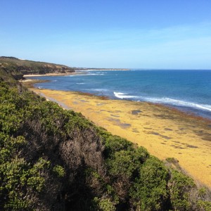
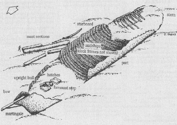
In 1869, the 1750 ton iron sailing ship “Victoria Tower” was on its maiden voyage to Melbourne for the White Star Line. Arriving at the Heads at night, the weather was stormy and foggy. Currents in the area were pulling Victoria Tower off its set course. At 1am, the ship crashed into rocks between Bream Creek and Spring Creek. Anchors were immediately let go to hold the ship, but it was driven broadside onto the sea, some 400 yards from shore. The crew made it to safety but the shattered vessel soon broke up.
The wreckage extends for approximately 100 meters and lies broadside to the shore with its bow facing east. The site is subject to heavy surge even in a low swell. When nearby rivers are in flood the visibility is very poor. The wreck has been extensively salvaged, though divers can sometimes see fragments of ceramics scattered around the wreck.
Pt Addis Marine Protected Area
2-10M
This area offers difficult access with long walks and surface swims out to the deeper offshore reefs. The fit persistent are rewarded with excellent marine life on limestone reef. The only really viable access is down a path that leads down to the eastern side of the point. This track starts about 200M back from the lookout car park. The site is exposed and calm weather is required. The site is exposed and rarely dived. If the weather is bad, the scenery is still worth the journey.

Pt Roadnight
2-8M
This little point offers a sheltered boat launching beach, a great family beach and an impressive set of eroded landforms worth a look even if not diving. The limestone ledges off the point are also worth exploring, but only on a very calm day. Unfortunately the sheltered part of the bay is sandy and shallow, but worth a snorkel with the kids.

Eagles rock MPA
2-8M
Many drive to the car park off Lighthouse Rd and walk back 30 M to a set of stairs that lead down to a beach. It is a long snorkel from here over shallow reef to the tip of the point. The spectacular Eagle Rock is sitting in an area of shallow water, but offshore there are deeper limestone reefs with good marine life. Life all spots on the surf coast the shallows can get stirred up and murky after heavy weather.

Pt Grey Lorne
0-3M
The very shallow and weed strewn bottom under the jetty is worth a snorkel or night dive. Watch out for fishing lines and boat traffic.
The seaward side of the point, a long way from shore, also offers deeper and more interesting reefs, some over 10m deep.
Mt Defiance to Grey River
All of the foreshore along the Great Ocean Road offers a sting of limestone reef well offshore in depths up to 10 metres. They are similar to the rest of the coast, requiring good weather and fit, experienced parties who can read the weather and make the long surface swims required.

Wreck of the barquentine “Speculant”
The “Speculant” had previously been involved in the Baltic timber trade be until bought by an Australian firm in 1906. The “Speculant” shipped white pine from Kaipara, New Zealand to Warrnambool. A month of east and south-easterly winds had forced the “Speculant” to remain sheltered in Lady Bay, Warrnambool. As the wind shifted north the “Speculant” got underway and tried to sail around Cape Otway, but it had to return and seek shelter in Portland. They tried again a few days later in a heavy sea. A strong cross wind and sea were acting on the vessel to steadily drive it towards the shore. At 3.30am on Friday she suddenly struck the rocks. One of the crew got a line ashore, and the rest of the crew were all able to escape. A rock was quickly driven through the bottom of the wreck in the heavy seas and she was abandoned. Rusting remains of the wreck can still be found on the shoreline on the southern side Cape Patton. Parts of the “Speculant” site have been buried by rubble from road works and landslides. It is worth a snorkel on a super calm day, but there is nowhere to get a car park or access to the shore, necessitating a 2km walk along the foreshore at low tide.
Wreck of the S.S. “Casino”
9M
38 44.60 S 143 40.75 E
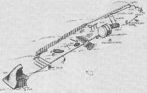
The 160.4ft long iron screw steamer S.S. “Casino” was built in Dundee in 1882. The ships gross tonnage was 425 tons and it could carry 71 passengers as well as cargo. The SS Casino made 2,500 voyages in Bass Strait. On 10th July 1932 the SS Casino was preparing to berth at the Apollo Bay pier in a south-easterly gale. All attempts to tie up the vessel were unsuccessful and the steamer bumped heavily on the sandy bottom. They let out the anchor but all this did was cause the anchor to pierce the hull of the vessel as it bumped on the bottom. The vessel had to steam backed out into the middle of the bay. As the waters rose the captain tried to beach the vessel. The steamer keeled over and sank and eleven crewmen lost their lives. Extensive salvaging of the SS Casino has taken place over the years.
The wreck of the SS Casino lies 400 meters offshore on a flat sandy seabed, just beyond the breakers at the northern end of Apollo Bay, almost opposite Wild Dog Creek. The site can suffer from poor visibility and surge even in low swells. Reduced visibility also occurs when the local river is in flood. The hull is relatively intact at the bow and near the engine and boiler. Toward the stern the vessel has collapsed and many parts of the wreck are heavily sanded over. The anchor is on display at the Apollo Bay post office and the steering wheel and other relics can be seen in the local hotel and maritime museum.
Apollo Bay Boat Harbour
3-5M
This artificial harbour is always calm and thus is popular with dive courses. It is sandy with a luxurious cover of seagrass offering plenty of smaller creatures to look at. It is a harbour, so stay away from boats or lose the privilege of diving there. The introduced Japanese pest seaweed Undaria has been found in the harbour, so wash and dry your gear before moving to another area.
The reef off Breakwater Road is also a worthwhile dive in good weather.
Wreck of the “Grange” Hayley Reef – Marengo MPA
7m
The Grange was built in Scotland in 1840 and had previously worked in the Caribbean. On the 22 March 1858 while on a trip from Melbourne to Guam the Grange headed for the Cape Otway lighthouse, the only light on the coast. In the poor light the small timber-cutting settlement of Apollo Bay was mistaken for the lighthouse and the vessel ran straight onto Little Henty Reef at Apollo Bay. No lives were lost and the cargo, hull, sails and fittings were all salvaged while the rest of the vessel broke up over time.
The site is located 300m from shore along the north-eastern side of Little Henty reef, within the Marengo Reefs Marine Sanctuary. The site is broken up and scattered along approximately 100m of the reef. Much of the site is covered by a dense cover of Bull Kelp over 1m tall. The site is prone to surge but relatively sheltered. It is a widely scattered site consisting of fastenings, hanging knees and timber planking. Iron remains including a large pipe can be seen at the reef/sand interface.
Marengo Reef MPA
The Inner Reef and Outer Reef are the only larger islands between Cape Schanck and Peterborough on the outer coast. They offer shelter and protect a foreshore beach that is a great shallow family day out for swimming or snorkelling. The outer parts of the reef on the exposed sides also offer some challenging diving.
Off the Southern tip of the island there is a 30+m gully that’s a very nice dive. You can dive on 15-20m deep reefs to the South west of the Islands. It is about 7-8m deep between the two reefs where there is a very pretty collection of sponges. There is a deeper 30M hole on the sheltered side of the islands.
Bubble Weed is the dominant canopy seaweed ain the areas protected from high wave energy by the Outer Reef. Bull kelp dominated elsewhere. Fourteen other species of brown algae and seven species of red algae, including encrusting coralline algae, form an understorey below the canopy.
Common invertebrates seen include black-lip abalone, periwinkles and sea urchins. Leather Jackets, purple wrasse, blue-throated wrasse, red mullet and magpie perch are common.
The Outer Reef supports a haul out area for approximately 200 Australian Fur Seals. Walking on the reef is not allowed to avoid disturbing the seals, birds and the intertidal animals.

Blanket Bay and Cape Otway
Shore access points exist at Cape Otway at the small Blanket Bay campsite. Other rough tracks close to the lighthouse car park also offer access to extensive areas of limestone reef. The areas is very exposed and is rarely dived, but has good fish life. It requires a day of exceptionally good weather.
