Anyone interacting with the ocean will be aware of water quality and rightly complain about the cloudy swimming conditions near the local stormwater outfall. However, the causes of cloudy waters are varied and aren’t always about human pollution. Some marine life loves it!

Turbidity is a measure of water clarity or murkiness. It provides a way of measuring the degree to which light is being scattered and absorbed underwater. Suspended particles in the water might include clay and silt, algae and zooplankton, coloured dissolved organic matter (CDOM- basically anything organic including perhaps sewerage). Changes in turbidity levels in coastal and estuarine waters can be a good indicator for the health of the oceans.
Tides
Tide-dominated coastal waterways are naturally turbid because strong tidal currents stir up fine sediment. Much of the tropical north can have challenging visibility due to the big tidal range and fine sediment-dominated seabed. Turbidity levels can vary a lot due to the spring-neap cycle of tides and the daily cycle of high and low tides.

A example of a poor visibility area that is tide driven is Darwin harbour. The inner harbour is often dark at any depth and green in the shallows. A visit to the war wrecks or old refugee boats is like a night dive. It doesn’t mean its dead, instead deep water invertebrates are found in a fascinating array, as they don’t have to compete with hard corals or algae that needs sunlight.
The salt wedge
Other turbid places are in estuaries where salt water meets the outgoing fresh water. This creates a ‘salt wedge’ and there is poor visibility along this boundary. This moves up and down the river depending on freshwater outflows and tides. Combine it with a big upstream factory and you have a barrier that backs up sediments. One example is the paper mill in the upper Derwent, that for many decades made the upper Derwent above the Bridgewater bridge, a dark lifeless world of mud.

Erosion
Humans do have a big impact by causing fine sediment to enter waterways from gully and streambank erosion. Clearing for agriculture has had a big impact in Queensland where vast sugar cane fields are combined with huge rainfalls and rivers prone to periodic flooding. They flood the Great Barrier Reef with sediments, nutrients and pesticides that cause smothering by sediments in the inner reef and outbreaks of Crown of Thorns starfish on the rest of the reef.

Urban run-off
Other causes of turbidity in coastal waters include sewage treatment plants and wash from construction sites, shoreline erosion, dredging and oil washed off roads. This is most noticed in highly urbanised and enclosed waterways.
The most obvious effect of increased turbidity is a reduction in light available for photosynthesis. Sensitive species like seagrass tends to die back near big cities. Suspended sediment can smother organisms on the bottom and their habitats. It can cause impair the gills of fish and crustaceans. It can also lead to algal blooms and deoxygenation of the water.
Pt Phillip Bay is in surprisingly good condition despite millions of people living beside a bay that only slowly flushes with fresh ocean water. In the upper bay it is dark and slimy, in the lower bay, the ocean is still teeming with life.
Plankton blooms – What does “chlorophyll A” mean?

One way of thinking of the oceans are that they can be like big, wet, paddocks. When the sun is shining, it’s warm, and there are enough nutrients from ‘fertiliser’, the ‘grass’ starts to bloom and sometimes get out of control. Just like the grass in a meadow, at the base of the ocean food web are single-celled algae and other plant-like plankton that feed on sunlight. Just like plants on land phytoplankton use chlorophyll and other pigments to convert sunlight into energy.
The highest chlorophyll concentrations, are in places where ocean currents bring cold water to the surface. Cool temperatures are a sign that the water has welled up from deeper in the ocean, carrying fertilising nutrients to the surface. In many coastal areas, the rising slope of the sea floor pushes cold water from the lowest layers of the ocean to the surface.

Cold coastal upwelling is most evident along the west coasts of North and South America and southern Africa. The polar areas also have a lot of plankton. The Bonney upwelling in Western Victoria charges the water with plankton and makes the water cloudy, but that phytoplankton is food for seabirds, whales and fish. The area- bursts with life.
Nutrients from pollution
In other areas like an enclosed waterway, high chlorophyll levels can indicate poor water quality from pollution. Chlorophyll a concentrations are also often higher inshore after rainfall has flushed nutrients into the water. Higher chlorophyll a levels are also more common during the summer months when the temperature and sunshine increases.

Measuring turbidity
The old way of measuring turbidity was to suspend a disc (called a Secchi disc) in the water on a rope and measure how deep it went before no longer being visible. This lacked both precision and the sense of cleverness you get from using a cool gadget.
In transmissometry and Nephelometry, a calibrated beam of light is projected through the water. The loss in the scattering or absorption of light is then measured. These methods are sensitive to very low turbidity levels and is commonly used in the open ocean. You could also take a water sample and test for plankton, but the days of using a seasick PhD student in a dinghy are over.
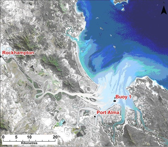
Chlorophyll in the plankton changes the way the ocean surface reflects sunlight, allowing scientists to map the amount of phytoplankton. Much quicker is satellite remote sensing, from NASA’s Aqua satellite. The sampling from boats can now be replaced with ARGO floats and gliders. They can stay at sea for extended periods in any weather and don’t often get seasick.
NASA/http://www.ozcoasts.gov.au/indicators/chlorophyll_a.jsp
